Local Attractions

Coastal Footpath behind Peel Castle

26Apr

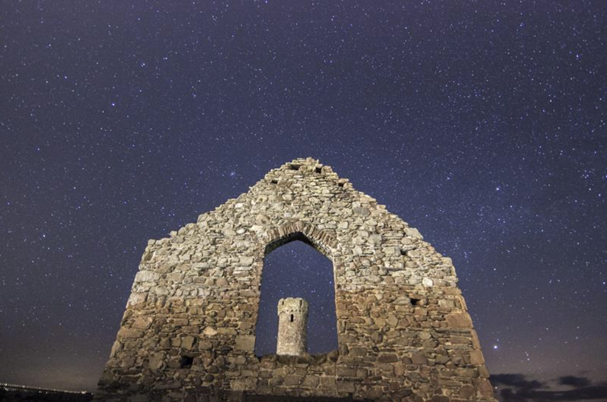
Follow the coastal path around Peel Castle to enjoy the panoramic views looking out to sea. With minimal light pollution, it’s a perfect place to admire the stars over the North West and South.

Peel Castle is one of 26 registered Dark Sky Discovery Sites on the Isle of Man. With the help of Interpretation Boards on site, stargazers can fully enjoy the stunning views on offer in the Manx skies.

Advice and Safety:

To access the stargazing site, follow the coastal footpath on the right of the castle, under the stone archway. The path is narrow and leads to a grassed viewing area. The footpath has steps present, but the first part is flat.

Peel Beach

26Apr

Peel Beach is situated on the Island’s west coast. It has a golden, gently sloping, sandy beach set in a beautiful bay, bounded by Peel Castle and the Peel Harbour on one side and red sandstone cliffs on the other.

Peel Beach is popular with both visitors and locals alike and has lots of facilities in the vicinity including easy parking, ice cream parlours and cafe’s. Treats to try on Peel promenade include its famous crab sandwiches and locally produced ice cream.

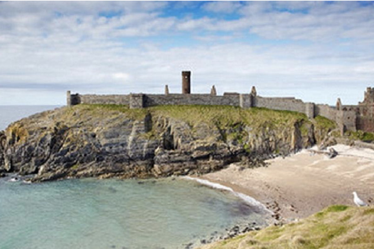
The view to the south of Peel Beach is of the magnificent, medieval Peel Castle situated on St Patrick’s Isle. In the foreground you will see the Peel’s Breakwater where the River Neb flows into the sea. The breakwaters are popular for fishing spots especially for mackerel. You can regularly see seals here. Peel is the Island’s main fishing port with boats regularly leaving and entering the harbour. A hidden gem tucked away next to the castle is the beautiful Fenella Beach, one of the Island’s most photographed beauty spots.

It is not without reason that Peel is known as the “Sunset City”. This west facing beach is blessed with stunning, unforgettable sunsets and views over the Mountains of Mourne in the distance.


Fishing:

There is a good variety of angling opportunities around Peel Bay. If fishing from the beach itself, concentrate on the northern part.There is good fishing and easy access from the rocks that surround the Castle. Locals also often fish from the end of the harbour wall. Typical species caught from the rocks and harbour wall include pollack, ballan wrasse, coalfish, cuckoo wrasse, grey mullet, mackerel and conger eel. From the beaches further to the north of Peel there is also excellent fishing for Bass and Tope.

The best fishing tends to be on the incoming tide three hours before high water, and a couple of hours after.  Let someone know where you are intending to fish before you go, and when fishing rock marks, be aware of the state of the tide and keep an eye on rising water to avoid being cut off from the shore.

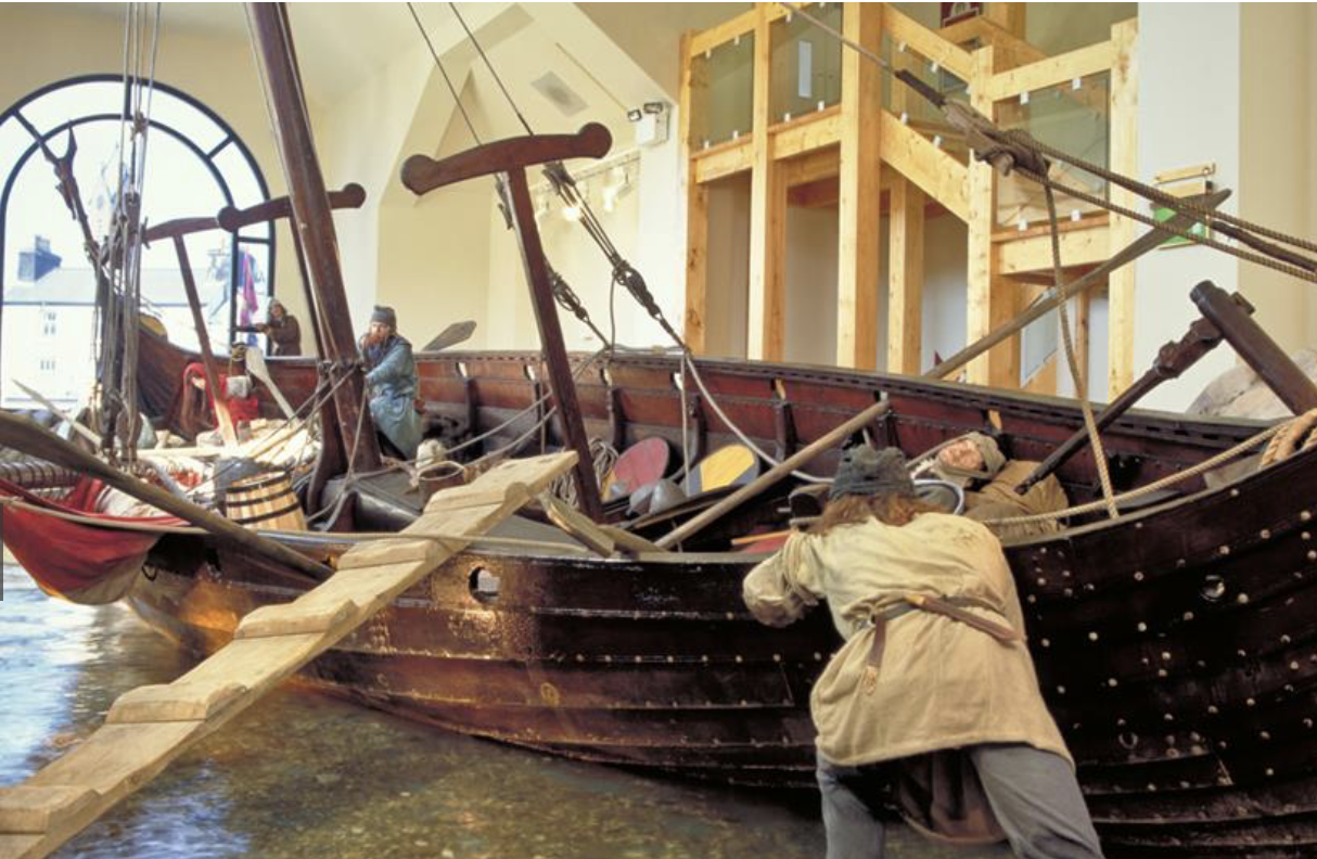
House of Manannan

26Apr

Niarbyl Bay

26Apr

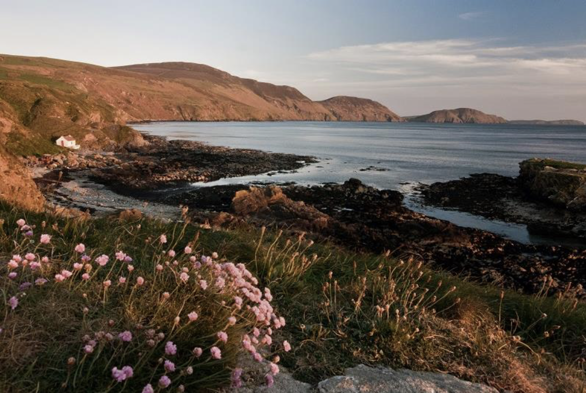
Niarbyl is a secluded beauty spot just south of Dalby Village on the Island’s west coast. Discover the peaceful bay with its rolling hills, thatched cottages and dramatic coastal paths leading to White Beach. Sunsets are remarkable in this scenic location and on clear nights exceptional for stargazing.

On a walk along the coast you will be able to see one of the most interesting of the Island’s ancient Keeils or early Christian chapels Lag ny Killey. You’ll also find quaint thatched cottages, which were featured in the film Waking Ned, and a coastal footpath which leads to an 8th Century chapel and secluded beach.

During your visit you’ll be offered spectacular views of the rolling hills and on a clear day you may be able to see the Mountains of Mourne in Ireland.

Spot seabirds, seals and possibly basking sharks, particularly on calm sunny days between May and August. An information board and binoculars are also located at Niarbyl to assist with wildlife spotting.

Fishing:

The rocks around Niarbyl offer plenty of opportunities for angling. Typical species caught include Pollack, Ballan Wrasse, Cuckoo Wrasse, Mackerel and Conger Eel. Take care not to get cut off by the tide if you are fishing from the tail of rocks.

The best fishing tends to be on the incoming tide three hours before high water, and a couple of hours after.  Let someone know where you are intending to fish before you go, and when fishing rock marks, be aware of the state of the tide and keep an eye on rising water to avoid being cut off from the shore.
Cringle Reservoir

26Apr

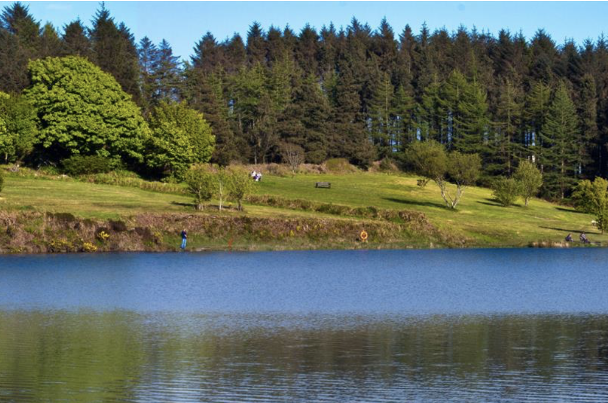
Cringle Reservoir offers fly and spin fishing. Surface area 4.5 acres, depth 21 metres. Map ref: SC 252 743. Postcode for satnav (not exact): IM9 3BA .

This beautiful reservoir in the south of the Island is located within the Cringle Forestry Plantation, at the foot of South Barrule hill, about 5 km northwest of Ballasalla.  With the exception of the top corner, the entire perimeter is fishable with good fly fishing clearance on most banks. There is a substantial wheelchair-accessible platform close to the disabled users’ car park.

This reservoir offers high quality stocked rainbow trout from 2lb upwards into double figures, along with the occasional wild brown trout. The reservoir is stocked between March and October on a regular basis. An Isle of Man Government Reservoir Licence is required to fish this reservoir.

Match the hatch on an evening rise, and you are sure to have fine sport.  Dry fly, wet fly and nymphing all produce fish.  Favourite dry patterns include Olives, Gnats, Midges and in August & September big Daddy Longlegs patterns.  Buzzer patterns work well for fish sipping from the surface film.  When there is no sign of fish, try a weighted nymph pattern fished on a long leader on a floating line.  Cold weather or seasonal low temperatures will require the use of a wet line to get your fly or lure deeper to fish that are hugging the bottom.  For lure fishing use simple reliable bladed spinners such as Mepps and Abu patterns.  Try a variety of colours until you begin to generate takes.

Parking: There is a large car park at the reservoir.  Disabled anglers can be issued a key to the disabled users’ car park (next to the wheelchair-accessible fishing platform) by Manx Utilities tel. (01624) 687687 or from DEFA headquarters, Thie Slieau Whallian, St Johns tel.(01624) 685857). Proof of eligibility and a small deposit is required.

Season Information: In summer (10th March – 31st Oct.) there is a four fish bag limit (two for a concessionary season licence) while in winter there is a two fish limit for all licence holders. Barbless hooks must be used in winter. The reservoir is closed to fishing from 1st February to 9th March (inclusive).

Glen Maye River

26Apr

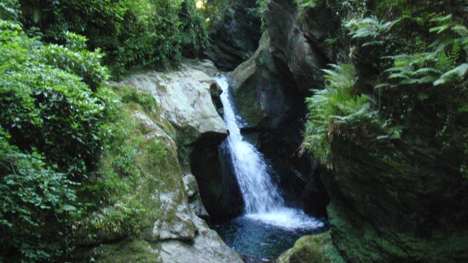
This river flows down from Glen Rushen to the sea near the village of Glen Maye in the west of the island.  The Glen itself lies 4.5 km south of Peel on the A27 coast road.  Parking and public toilets can be found at the top of the beautiful glen walk.  A set of steep steps will lead you past a spectacular waterfall and down to the river.  Downstream of the waterfall, wild brown trout lie shaded by the steep walls of the gorge.  There is also a long stretch of public fishing upstream of the village, where the river runs for almost 2km alongside the Arrasey and Lhargan plantations. Access to this area is from the Glen Rushen Rd that leaves Glen Maye village, limited parking and a picnic area can be found at the end of this road.

Tynwald National Park & Arboretum

26Apr

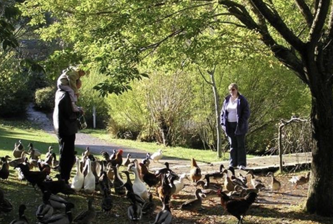
A perfect place to enjoy a picnic on a hot summer’s day or to get some fresh air and feed the ducks!

Situated in St Johns the Tynwald National Park and Arboretum is set in more than 25 acres of picturesque countryside.

Within the park you’ll find a wide range of ornamental and native tree species as well as trees from the Island’s 17 Manx parishes as well as a specially constructed shelter and picnic area with fantastic views over St Johns.

You’ll also discover a large pond where you can feed the ducks and a children’s playground to keep the little ones entertained.

Tynwald Hill

26Apr

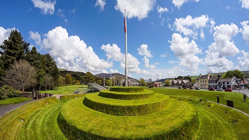
This four-tiered hill is one of the Island’s most distinctive landmarks and a signal of the Isle of Man’s independence as a self-governing crown dependency.

Tynwald Hill, which is located in St Johns, plays host to an open air meeting of the Island’s parliament, Tynwald, once a year.It is believed that the open air ceremony, which takes place on July 5th, was established by Norse Viking settlers over a thousand years ago with the hill thought to have been built in the 13th century.

The hill, which measures around 12 feet high, is thought to be made from piles of stones bonded together with soil from all of the Island’s 17 ancient parishes.

Ancient graves have been also uncovered near the hill and a temple dedicated to the Norse god Thor was found near to the site of St John’s Church.

Archallagan Forest

26Apr

Situated east of Foxdale, lies Archallagan plantation, a favourite among families and sport enthusiasts.  With an elevation of over 600 feet, parts of the plantation are very exposed, whereas other sections are almost glen like; ranging from marshy bog land to rough moorland.

Archallagan, also known by some as the Forest of a Thousand Trails, is extremely popular among mountain bikers and horse riders, with many different routes and unmarked paths being present within the plantation. In addition, Archallagan boasts a newly created exercise trail and play area, perfect for a family outing.